The German Federal Ministry of Transport and Digital Infrastructure (BMVI) is looking for solutions that use Copernicus data to solve major challenges faced by transport systems today.
Solutions can solve challenges on the local, national or international level and can target any mode of transportation. Participants are encouraged to use Copernicus data along with additional data sources such as traffic information, or other mobility-related data.
Areas of interest to the BMVI include:
- Transport infrastructure: Ensure the ongoing quality, safety and maintenance of road, rail, or aviation infrastructure
- Environmental impact: Monitor or improve the impact of transport on the environment, such as emissions, oil dependency, or reduction of natural habitats
- Freight transport and logistics: Develop new concepts to deliver goods as fast as possible to their destination – but also taking cost, noise pollution, and the environment into consideration
- Maritime safety: Ensure or improve the efficient and safe operations of maritime transport, considering additional factors such as fuel consumption, weather forecasts, ship tracking etc.
Prizes:
The winner
Cash prize EUR 5,000
Cloud computing
Access to cloud computing facilities and Copernicus data via the “Copernicus Data and Exploitation Platform – Deutschland” (CODE-DE)
Event
Attendance and presentation at a transport related event of the German Aerospace Center (DLR) (if eligible)
Satellite data
Possibility to access EUR 10,000 worth of commercial datasets from the Copernicus Contributing Missions in the Copernicus Data Warehouse (financial support by EC)
Criteria:
Submissions to the BMVI Digital Transport Challenge will be evaluated against the following criteria:
Innovation
Does the solution present a novel/new approach to solving transport challenges?
Societal benefits
Does the solution show significant value for today’s transport systems, society and/or the environment?
Technical Feasibility
Does the solution apply Copernicus data to provide value-added services to end-users?
Commercial Viability
Does the solution have real market potential?
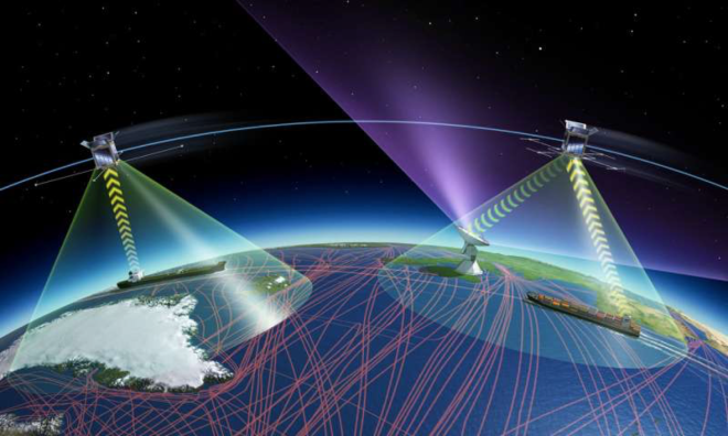
Space-based services provide global ship tracking, reduce pollution, and promote monitoring of dangerous cargo.
Maritime: Autonomous ship connectivity is another use case that will become an important trend with the integrated satellite-terrestrial systems. These systems could enable transfer of location information to remote control center and data communication with other ships or navigation in coastal areas.
For instance, a shipping container connected by satellite in the ocean could switch to being linked by a cellular network near a port. The current infrastructure is not suitable for this scenario and thus hybrid networks will pave the way for an emerging area of autonomous shipping.
Dateline for submission: 30 June 2019
Source: Copernicus Masters


सोचो वैश्विक स्तर पर *放眼全球 *THINK GLOBAL*思う グローバル* فكر عالميا
Business Development – Innovations & Future Technology – Investment


Turning the tide on climate change – Enel Open Innovability

European Pre-Commercial Procurement Programme for Wave Energy Research & Development

The OCEARCH an collaborative, inclusive and open-sourced project to geared to helping scientists collect previously unattainable data on animal movements from deep in the world’s oceans.
Track sharks, whales, turtles, seals, dolphins, alligators
¡Muchas gracias a todos y respeto!